 |
Santa Rosa County |
 |
Code of Ordinances |
|
Appendix D. 2040 COMPREHENSIVE PLAN |
|
Appendix 1.0. Future Land Use Element Supporting Documentation |
§ 1.1. Santa Rosa County Land Use Planning Framework
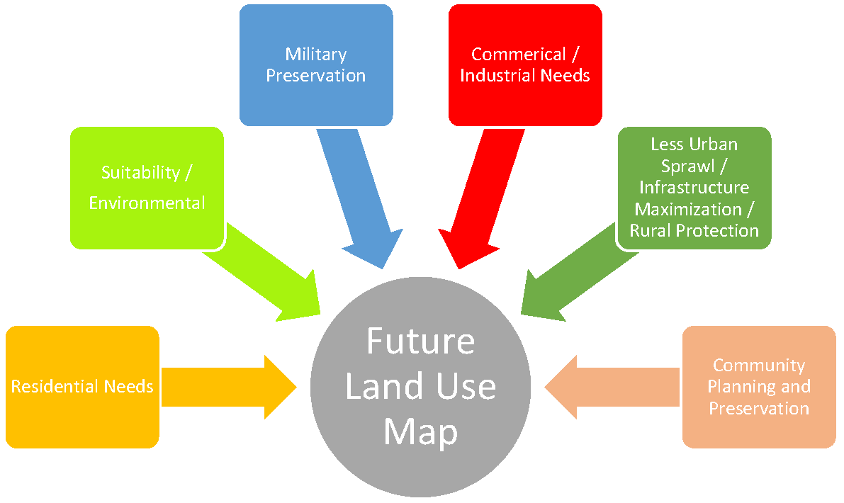
Figure 1-2: Land Use Planning Inputs
As shown in Figure 1-2 above, the development of the County's Future Land Use Map includes several major inputs. A description of these inputs and how they relate to the County's land use planning program is provided below.
1.1.1 Residential Needs and Commercial/Industrial Needs
Two of these inputs, residential needs and commercial/industrial needs, are addressed through analysis of the existing Future Land Use Map and its ability to provide adequate lands for these land uses through the Plan's timeframe, 2040. Conceptually, it is ideal to provide these lands in areas that are not environmentally sensitive, have adequate infrastructure and in areas that do not compromise military operations within the County. This Chapter contains an analysis of the availability of lands to accommodate future development as well as the suitability of vacant lands for development.
1.1.2 Suitability/Environmental
Environmental suitability was considered when special land use categories where created for the Garcon Point area and in the creation of the Conservation land use category. Santa Rosa County has abundant natural resources and environmentally sensitive areas—the Blackwater and Yellow Rivers, the Yellow River Marsh Aquatic Preserve, the Escambia, East and Blackwater Bays, the Santa Rosa Sound and the County's coastal areas including The Gulf Islands National Seashore, the Garcon Point peninsula and Water Management Area, the Blackwater River State Forest, the Escambia River and Water Management Area, the Escribano Point Wildlife Management Area and the Eglin Air Force Base Preserve.
1.1.3 Military Preservation
Also important to the County's land use planning program is the insurance that our military installations are protected and can continue viable operations. The Joint Land Use Study and other military preservation plans/programs have been implemented within the Comprehensive Plan's Future Land Use Element.
1.1.4 Less Urban Sprawl/Infrastructure Maximization/Rural Protection
Santa Rosa County has an active agrarian economy in the northern County and preservation of farmland and rural lifestyles are considered of paramount importance. In order to protect farmlands and rural lifestyles, the Rural Development Plan has been partially implemented within the Future Land Use Element. The Rural Development Zone, as implemented, coincides with the northern boundaries of several sewer and water franchise areas (Pace, Milton and East Milton) and the Plan contains policies geared towards increasing development in areas where central services are provided. Also, in order to look at infrastructure maximization, planning areas have been created to analyze central water and sewer availability within the County's growth communities from a data and analysis perspective. This concept can also be applied to capital improvements planning for roads.
1.1.5 Community Planning and Preservation
Finally, the County has unique historical or culturally significant communities such as Milton, Bagdad and Floridatown as well as other defined but unincorporated residential communities such as Pace, Navarre and Navarre Beach that have warranted small area planning efforts over the years. In addition, two small area planning efforts, the Navarre Beach Master Plan and the Bagdad Historic District Plan have been implemented on the Future Land Use Map.